
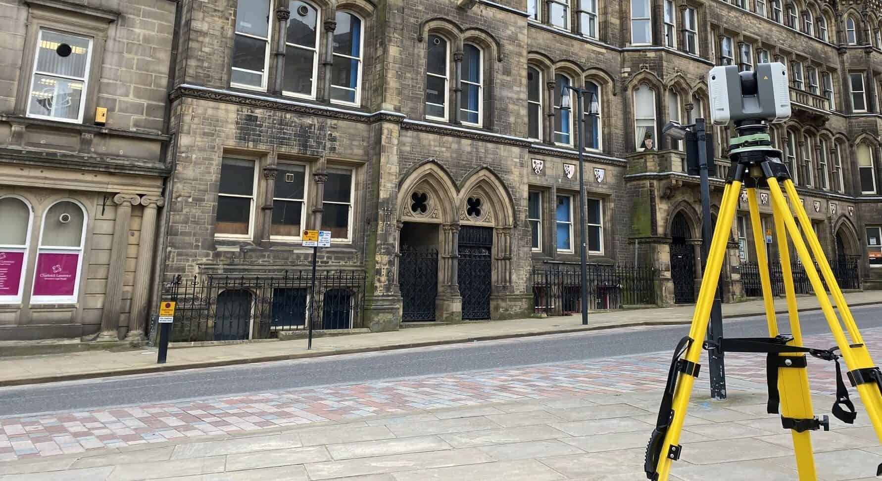
3D laser scanning has quietly become the difference between construction projects that run to programme and those that stall over measurement disputes. Most articles on the subject list the same benefits in the same order: speed, accuracy, safety. What they rarely explain is why accuracy fails on complex projects in the first place, and why laser scanning solves problems that traditional construction surveying methods physically cannot.
That is what this article covers. If you are an architect, engineer, developer or BIM specialist weighing up whether a point cloud survey is worth the investment on your next project, the sections below explain where the real value sits, where the limitations are, and what to look for in a survey partner.
The Real Cost of Inaccurate Measurement
The construction industry has a rework problem. Studies consistently place the direct cost of rework at somewhere between 5% and 12% of total project value, and a significant share of it traces back to one root cause: teams designing and fabricating against measurements that do not reflect what actually exists on site.
On a simple new build with generous tolerances, small measurement errors get absorbed. On complex projects they compound. A steel connection detailed from a floor plan that is 40mm out. Ductwork fabricated off site that will not fit through a riser. A curtain wall ordered against gridlines that drifted during the frame pour. Each of these is a familiar story to anyone who has managed a refurbishment or a dense urban build, and each one starts with a survey that captured less than the full picture.
Traditional measured survey methods, using total stations and manual measurement, are accurate at the points they record. The weakness is coverage. A surveyor records hundreds or a few thousand discrete points and everything between those points is interpolated or assumed. On a regular rectilinear building, that assumption usually holds. On a Victorian mill with bowing walls, a live industrial facility crowded with plant, or a structure that has settled unevenly over a century, it does not.
What 3D Laser Scanning Actually Changes
A 3D laser scanner captures millions of measured points per second, recording the position of every visible surface to millimetre-level accuracy. The output is a point cloud: a complete, measurable, three-dimensional record of the site as it genuinely exists. This is why the approach is often called reality capture. It removes the gap between what the drawings say and what the building does.
For complex construction projects, that shift matters in five specific ways.
1. It captures the building you have, not the building on the drawings
Existing drawings lie. Not deliberately, but historic record drawings reflect design intent rather than as-built reality, and buildings move, settle and get altered over decades. A point cloud survey documents the true geometry: the wall that leans 60mm over three storeys, the floor that falls 90mm across a bay, the beam that was installed 150mm lower than the archive drawing shows.
On refurbishment and retrofit projects, this is frequently the single largest accuracy gain. Design teams working from scan data stop discovering geometry problems on site and start resolving them at design stage, where they cost a fraction as much to fix.
2. Complete coverage removes the “we didn’t measure that” risk
Because the scanner records everything in its line of sight, there is no need to decide in advance which dimensions matter. Six months into design development, when the structural engineer needs the soffit level in a corner nobody thought to measure, the answer is already in the point cloud. No return visit, no delay, no assumption.
This completeness is particularly valuable on live sites, occupied buildings and hazardous environments, where every additional site visit carries cost, disruption and risk. One scanning visit typically replaces several rounds of traditional measurement.
3. Millimetre accuracy feeds directly into BIM and fabrication
Point cloud data integrates directly into BIM workflows. Scan data can be used to build accurate Revit models of existing structures, to verify new construction against the design model, and to coordinate services in tight spaces where tolerances are unforgiving.
For off-site fabrication, this is where 3D surveying earns its fee many times over. Steelwork, modular MEP racks, bespoke joinery and façade panels can all be fabricated against verified as-built dimensions rather than nominal ones. When a fabricated element arrives on site and fits first time, that is usually a point cloud doing its job invisibly.
4. Construction verification catches errors while they are still cheap
Laser scanning is not only a pre-design tool. Scanning at key construction stages, such as after the frame is complete or before services are boxed in, allows the built work to be compared directly against the design model. Deviation analysis highlights where elements sit outside tolerance while correction is still straightforward.
Floor flatness surveys, façade verification, structural monitoring and clash checking against installed services all use the same principle: measure everything, compare it to what should be there, and act on the differences early.
5. It creates a permanent, auditable record
Disputes over dimensional accuracy are expensive precisely because the evidence usually no longer exists. Once the follow-on trade has covered the work, nobody can prove what was built. A dated point cloud is an objective record of site conditions at a specific moment, which has real value in claims, handover documentation and future asset management.
Real-World Scenarios Where Scanning Changes the Outcome
Abstract benefits are easy to list, so consider three situations that come up repeatedly on UK projects.
A historic building refurbishment in a city centre. The archive drawings date from the 1950s and two major alterations are undocumented. A measured building survey using 3D laser scanning captures every floor, elevation and roof void in a handful of days. The design team discovers the party wall is not parallel to the grid and the upper floors have spread outward. Because this emerges before Stage 3 design, the steel solution is adjusted on paper rather than renegotiated on site.
A live manufacturing facility installing new plant. Production cannot stop for a survey team to work around machinery with tapes and total stations. Scanning captures the entire installation zone, including pipe runs, cable trays and structural steel at high level, in a single short possession. The new plant and its connections are designed and fabricated off site against the point cloud, and installation is completed within the planned shutdown window.
A high-rise frame under construction. The concrete frame is scanned floor by floor as it rises. Deviation reports show one core wall drifting out of tolerance at level six. The issue is corrected two floors later rather than being discovered when the curtain wall brackets fail to align at level fourteen.
In each case the technology is the same. The value comes from applying it at the right moment in the project lifecycle.
The Insight Most Articles Miss: Accuracy Comes From the Survey, Not the Scanner
Here is the part of the conversation that gets skipped in most marketing content. The scanner itself is rarely the limiting factor in accuracy. Modern terrestrial scanners are capable of measuring individual points to within a few millimetres. What determines whether your final deliverable is genuinely accurate is everything around the hardware:
Registration quality. A scanning project involves dozens or hundreds of individual scan positions that must be stitched together. Poor registration silently accumulates error, so a scan that is millimetre-accurate locally can be centimetres out across a large site. Competent surveyors control this with targets, robust overlap and rigorous quality checks, and they report registration accuracy rather than quoting the scanner’s specification sheet.
Survey control. For point cloud data to align with site setting out, gridlines and other survey work, it must be tied into a properly established control network. This is traditional surveying discipline applied to modern equipment, and it is where an experienced land surveying practice differs from an operator who has simply bought a scanner.
Fit-for-purpose deliverables. A raw point cloud is not a design tool. The skill lies in translating it into what your team actually needs: 2D floor plans and sections, a Revit model at an agreed level of detail, a deviation report, or the cleaned and registered cloud itself. Agreeing the deliverable, the accuracy specification and the modelling tolerances before the survey starts prevents most downstream disappointment.
This is why the question to ask a survey provider is not “what scanner do you use?” but “how do you control registration, how do you tie into site control, and what accuracy will you certify in the deliverable?”
Is 3D Laser Scanning Right for Your Project?
Honest guidance includes knowing when the technology is not the answer. Laser scanning is the strongest option when one or more of the following apply:
- The existing structure is geometrically complex, historic or poorly documented
- Fabrication or off-site manufacture depends on as-built dimensions
- The site is live, occupied or hazardous and access time is limited
- The project uses BIM and needs an accurate existing-conditions model
- Verification against design tolerances is required during construction
- A defensible dimensional record is needed for handover or dispute avoidance
For a small, regular, well-documented building where only basic floor plans are needed, a conventional measured survey may remain the more economical route. A good surveying partner will tell you that plainly, and will often recommend a hybrid approach, combining laser scanning with drone survey data for roofs and inaccessible elevations, or with utility surveys where below-ground services affect the design.
The right question is never “should we use digital surveying?” in the abstract. It is “what decisions will this data support, and what accuracy do those decisions require?”
Why Premier Surveys for 3D Laser Scanning in the UK
Premier Surveys has been delivering professional surveying services across the UK since 1989, from offices in Nottingham and London. That matters for laser scanning more than it might first appear, because the discipline that makes point cloud data trustworthy, including control networks, registration rigour and clear accuracy reporting, comes from decades of core surveying practice rather than from the equipment alone.
The company is regulated by the Royal Institution of Chartered Surveyors (RICS) and certified to ISO 9001:2015, so every survey is delivered under a formal quality management system with professional accountability behind it. Laser scanning also sits within a wider set of geospatial services, including measured building surveys, 3D modelling, drone surveys, topographical surveys and utility surveys, which means complex projects can be supported end to end rather than piecing together data from multiple suppliers.
For architects, engineers, developers and BIM teams, that combination translates into deliverables you can design against with confidence: registered point clouds, accurate 2D drawings, and Revit models built to an agreed specification, with the accuracy statement to back them up.
Final Thoughts
Accuracy on complex construction projects is not achieved by measuring more carefully in the traditional sense. It is achieved by removing assumptions, and 3D laser scanning removes more assumptions than any other survey method available today. Complete coverage, millimetre-level data, direct BIM integration and stage-by-stage verification all point at the same outcome: problems found on screen instead of on site, and budgets spent on building rather than rebuilding.
If you are planning a refurbishment, a fabrication-led build or any project where existing conditions carry risk, speak to Premier Surveys about a 3D laser scanning survey. A short conversation about your deliverables and accuracy requirements at the outset is the cheapest risk reduction available on any complex project.
Contact Premier Surveys to discuss your project or request a quotation at premiersurveys.co.uk.