
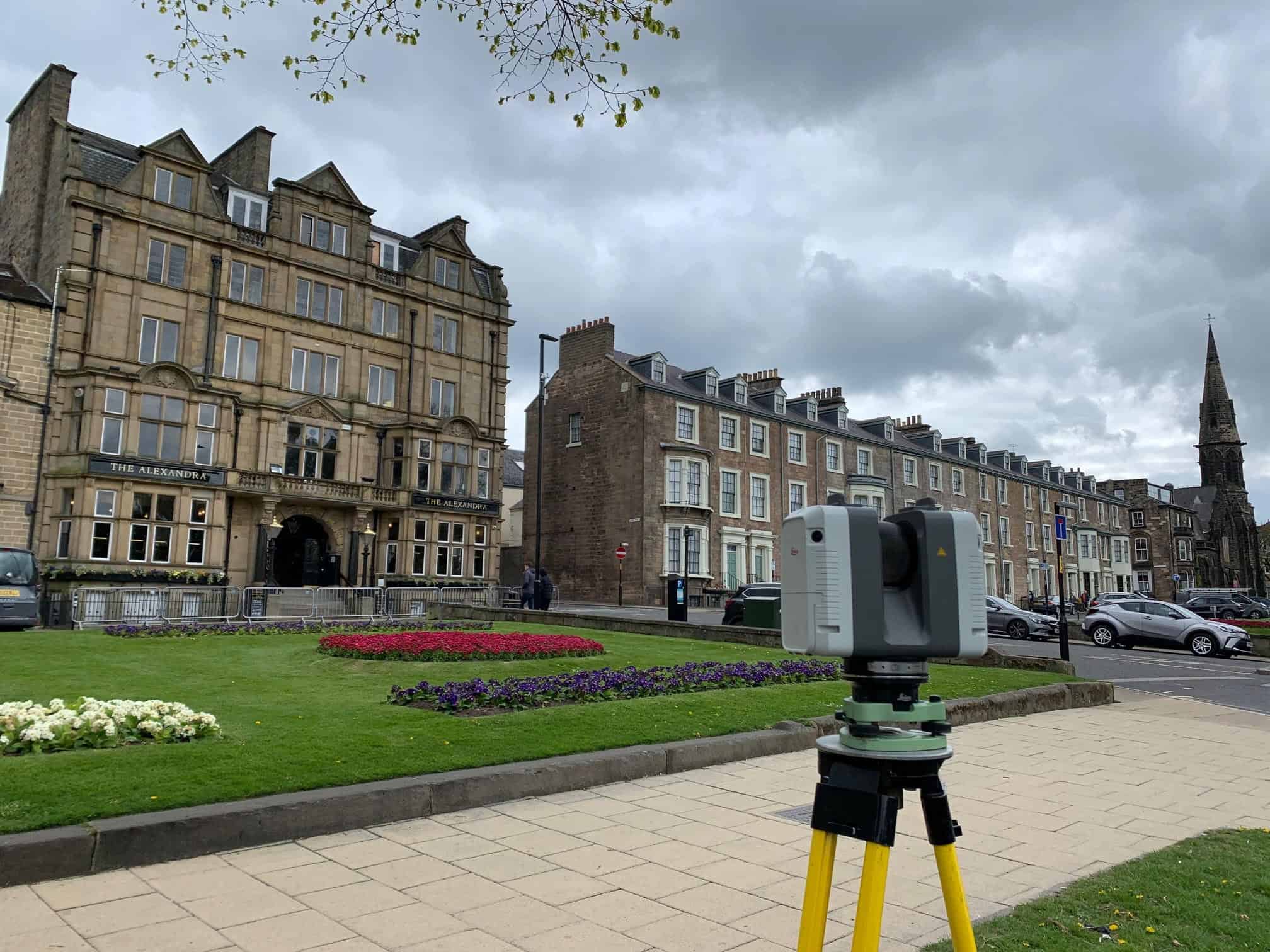
3D laser scanning has become the default recommendation for almost every measurement problem in construction, and that is precisely the problem. Ask three different survey companies whether you need a laser scanning survey or a traditional approach and you will often get three confident, contradictory answers. Most articles on this subject will tell you that scanning is faster, richer and more modern, then stop there. That is not a useful answer if you are an architect pricing a refurbishment, an engineer planning a monitoring regime, or a developer deciding what level of survey data a project actually justifies.
The honest answer is that 3D laser scanning is dramatically better than traditional surveying in some situations, marginally better in others, and occasionally the wrong tool entirely. This article sets out where those lines fall, based on the kinds of projects UK surveying teams deal with every week.
The Industry Reality: Scanning Is Common, but Poorly Specified
Laser scanning is no longer new technology. High-definition scanners have been in mainstream UK surveying use for well over a decade, and reality capture is now embedded in BIM workflows, heritage recording and infrastructure monitoring. What has not kept pace is how projects specify it.
Two problems come up repeatedly on UK projects:
First, scanning is specified when it is not needed. A greenfield site earmarked for a housing development rarely benefits from millimetre-dense point cloud data across open grassland. A conventional topographical survey captures everything the design team will use, at lower cost and in a format they can work with immediately.
Second, traditional methods are specified when scanning would have paid for itself several times over. A complex Victorian building surveyed by hand with a disto and clipboard will almost always generate return visits, missed details and expensive design clashes that a single scanning visit would have prevented.
Both failures come from the same root cause: the decision is made on habit or budget line rather than on what the data needs to do downstream. So the real question is not “which method is better” but “which method is better for this project, this building and this design team”.
What 3D Laser Scanning Actually Does Differently
Before comparing methods, it is worth being precise about the difference, because “laser scanning” and “traditional surveying” are often described as if they were competing brands rather than fundamentally different data strategies.
Traditional land surveying, whether with a total station or GNSS equipment, is selective measurement. The surveyor decides on site which points matter: building corners, kerb lines, levels, tree positions, drainage covers. Every point captured is a deliberate choice. The output is lean, structured and immediately usable in CAD.
3D laser scanning is comprehensive measurement. The scanner captures millions of points per second across everything in its line of sight, producing a point cloud survey that records the entire scene, whether or not anyone thought it mattered at the time. Interpretation happens later, in the office, when the point cloud is processed into floor plans, elevations, sections, meshes or a 3D model.
That single distinction, selective versus comprehensive, drives almost every practical difference between the two approaches: cost, speed, revisit risk, deliverable format and long-term data value.
When 3D Laser Scanning Is Clearly the Better Choice
Complex or Irregular Buildings
The stronger the geometry, the stronger the case for scanning. Sloping floors, out-of-plumb walls, vaulted ceilings, ornate facades and structures that have been extended repeatedly over decades are exactly where hand measurement and even total station work struggle. A measured building survey delivered from scan data records the building as it actually is, not as a simplified rectilinear approximation.
On refurbishment and retrofit projects this matters commercially, not just technically. Design teams working from idealised drawings discover the real geometry during construction, when variations are at their most expensive. Scan-derived drawings and models push that discovery back to the design stage, where resolving it costs hours rather than weeks.
Live BIM Workflows and Scan-to-BIM
If the project deliverable is a Revit model, or the client operates a BIM mandate, a point cloud is the natural starting position. Scan-to-BIM workflows allow modellers to build directly against captured reality, verify the model against the cloud, and hand over an asset that reflects the building rather than the original design intent. Attempting to build an accurate as-built BIM model from selective total station points and hand measurements is possible, but it is slower, riskier and full of assumptions.
Sites Where Access Is Restricted, Hazardous or Expensive
Every site visit has a cost, and on some sites that cost is severe: live rail environments, operational industrial plants, highways requiring traffic management, confined plant rooms, or occupied buildings where disruption must be minimised. Because scanning captures everything in one visit, it collapses the revisit problem. If the design team later asks about a detail nobody anticipated, the answer is usually already in the point cloud. With traditional surveying, that question triggers another possession, another permit, another road closure.
This is one of the most under-priced benefits of reality capture. The scan itself may cost more than a conventional survey, but on access-constrained sites the second visit you never had to make often covers the difference on its own.
Structural Analysis, Deformation and Condition Recording
Point clouds excel at questions traditional surveys cannot really answer: how much has this floor deflected, how far is this wall leaning, where exactly does this facade bulge. Because the cloud is a dense, continuous record, surfaces can be analysed against best-fit planes and colour-mapped for deviation. Total station monitoring remains excellent for tracking discrete points over time, but for characterising the shape of a whole element, scanning has no real competitor.
Heritage, Legal Records and “Capture Everything Now” Situations
Where a building may be altered, demolished or is at risk, a scan is an archival record. Heritage bodies, insurers and legal teams increasingly value the fact that a point cloud is objective: it records the scene without a surveyor’s editorial decisions. Years later, new deliverables can be extracted from the same dataset without anyone returning to site, sometimes to a building that no longer exists in that form.
When Traditional Surveying Methods Still Win
It would be convenient for surveying companies to claim scanning is always superior. It is not, and pretending otherwise is how clients end up paying for data they never use.
Open Topographical Sites
For greenfield land, large development sites and rural topography, GNSS and total station surveying remain the sensible default. A topographical survey needs intelligent selection: the surveyor codes features, interprets ground changes, identifies services covers and captures levels where the terrain demands it. Scanning open ground produces enormous datasets dominated by grass and hedgerows, and vegetation actively degrades terrestrial scan quality because the laser records the canopy, not the ground beneath it. Where aerial coverage of large sites is needed, a drone survey with photogrammetry or LiDAR usually fits better than terrestrial scanning in any case.
Setting Out and Engineering Control
Construction setting out is the reverse of surveying: taking design coordinates and placing them physically on site. That is total station territory and always will be. Engineering surveys, precise level runs and control networks similarly rely on the targeted accuracy of traditional instruments. A scanner tells you where everything is; it does not put a peg in the ground.
Small, Simple and Fast Jobs
A single regular room, a small extension footprint, a boundary check or a handful of spot levels does not justify scan capture, registration and processing. A competent surveyor with a total station delivers the answer faster and at lower cost. Processing overhead is the quiet cost of scanning: the site work may take an hour, but registering, cleaning and modelling the data takes real office time that small jobs cannot absorb.
Boundary and Legal Measurement Work
Boundary determination depends on interpretation of deeds, occupation and legal principles, evidenced by precisely measured discrete points. The comprehensiveness of a point cloud adds little here, and the professional judgement of a chartered surveyor on site adds a great deal.
The Decision Framework: Five Questions That Settle It
Rather than debating technology, run any project through these five questions.
1. How complex is the geometry? Regular, rectilinear and modern points to traditional methods. Irregular, historic, congested or heavily serviced points to scanning.
2. What will the data feed? 2D CAD drawings for planning can come from either method. BIM models, clash detection, deviation analysis and digital twins effectively require a point cloud.
3. What does a return visit cost? If revisiting the site is cheap, selective capture carries little risk. If access involves possessions, permits, shutdowns or long travel, comprehensive capture is insurance worth buying.
4. How certain is the scope? If you know exactly what you need measured, traditional surveying delivers it efficiently. If scope may grow, as it usually does on refurbishment work, the point cloud absorbs scope change without new site visits.
5. What is the life of the data? Data for a single planning application has a short life. Data supporting an asset through decades of operation, or recording a heritage structure, justifies the richer capture.
If three or more answers point the same way, the choice is rarely difficult. Genuinely marginal cases usually resolve on question three, because revisit cost is the factor clients most consistently underestimate.
Real-World Scenarios from UK Projects
Scenario one: city-centre office refurbishment. A 1960s office block in Nottingham is being stripped back to frame and remodelled. The design team needs floor plans, sections, elevations and a Revit model, and the structural engineer wants to check slab deflection before committing to new loadings. This is an unambiguous scanning project. One capture visit serves the architect, the engineer and the BIM consultant simultaneously, and the deflection question is answered from the same dataset at no extra site cost.
Scenario two: 12-acre residential development site. Open pasture on the edge of a market town, needed for a planning application and drainage design. A conventional topographical survey with GNSS and total station, potentially supported by a drone survey for the wider terrain model, delivers everything required. Terrestrial scanning here would triple the data volume without adding a single useful design decision.
Scenario three: live industrial plant extension. A food production facility is adding a process line, and shutdown windows are limited to a few hours at weekends. Scanning wins on access economics alone: the entire plant room and route corridor are captured in one window, and every subsequent design query, pipe run check and clash test is answered from the point cloud rather than another shutdown.
Scenario four: rear extension to a semi-detached house. A measured survey of two rooms and the rear elevation. A surveyor with a total station and laser disto completes this in a morning at a fraction of the processed cost of a scan. Specifying scanning here is simply spending the client’s money on data nobody will open.
The pattern across all four is consistent: the technology follows the project, never the other way round.
The Insight Most Comparisons Miss: You Are Buying Optionality, Not Points
Here is the framing that experienced clients eventually arrive at. A traditional survey buys you answers to the questions you asked. A laser scanning survey buys you answers to the questions you asked, plus the option to answer questions you have not asked yet.
That option has real financial value on some projects and none on others. On a refurbishment where scope creep is near-certain, optionality is worth a premium. On a boundary check with a fixed, legally defined question, optionality is worthless and you should not pay for it. Once you evaluate scanning as an option purchase rather than a technology upgrade, the specification decision becomes a straightforward commercial judgement rather than a debate about equipment.
It also explains why hybrid approaches are so common on well-run projects. Many surveys combine methods: traditional control networks giving the scan data its coordinate accuracy, GNSS tying everything to Ordnance Survey National Grid, scanning covering the complex structures, and conventional techniques covering the open ground. The strongest digital surveying workflows in the UK are integrations, not either-or choices.
How Premier Surveys Approaches the Decision
Premier Surveys has been delivering measured survey work across the UK since 1989, which means the team has surveyed through the entire transition from purely optical methods to high-definition 3D laser scanning, drone capture and BIM-integrated deliverables. That history shapes how projects are specified: the starting point is the deliverable and the decisions it must support, not the instrument.
Operating from offices in Nottingham and London, and working nationwide, Premier Surveys provides both approaches under one roof: 3D laser scanning, 3D modelling and scan-to-BIM outputs alongside topographical surveys, measured building surveys, engineering surveys, drone surveys and utility mapping to PAS 128. The company is ISO 9001:2015 certified and regulated by RICS, so survey specification advice comes with professional accountability behind it.
In practice, that means clients are sometimes advised away from scanning when a conventional survey serves the project better, and sometimes advised into it when the revisit risk or model requirements make it the economical choice. Either way, the recommendation is evidenced against the project rather than the sales sheet.
Conclusion: Match the Method to the Decision, Not the Trend
3D laser scanning is better than traditional surveying methods when geometry is complex, when data feeds BIM or analysis workflows, when site access is costly, when scope is uncertain, or when the record itself has long-term value. Traditional land surveying remains better for open topographical sites, setting out, small well-defined jobs and boundary work. Most substantial UK projects benefit from a considered combination of both.
If you are weighing up survey methods for an upcoming project, the fastest route to the right answer is a short conversation about what the data needs to do. Contact Premier Surveys to discuss your project, and you will get a specification recommendation built around your deliverables, your site constraints and your budget, whichever method that points to.
Suggested FAQs (Schema Opportunity)
Is 3D laser scanning more accurate than a total station? Not on a point-by-point basis. A total station measures individual points to very high precision, while scanning delivers slightly lower per-point precision but captures millions of points, giving far better characterisation of whole surfaces and complex geometry. Well-executed scans are registered onto traditional control networks, combining both strengths.
How much does a 3D laser scanning survey cost in the UK? Costs vary with building size, complexity, access and the deliverables required, from point cloud only through to full Revit models. Scanning typically carries higher capture and processing costs than a conventional survey of the same site, but frequently costs less overall once avoided revisits and reduced design risk are counted.
Can laser scanning replace a topographical survey? For buildings and structures, largely yes. For open land, no. Vegetation and terrain interpretation make GNSS and total station methods, sometimes combined with drone capture, the better approach for topographical work.
What is a point cloud survey used for? Point cloud data is used to produce floor plans, elevations, sections, 3D models, BIM deliverables, deformation analysis and clash detection, and serves as a permanent digital record of a site or structure at the moment of capture.