
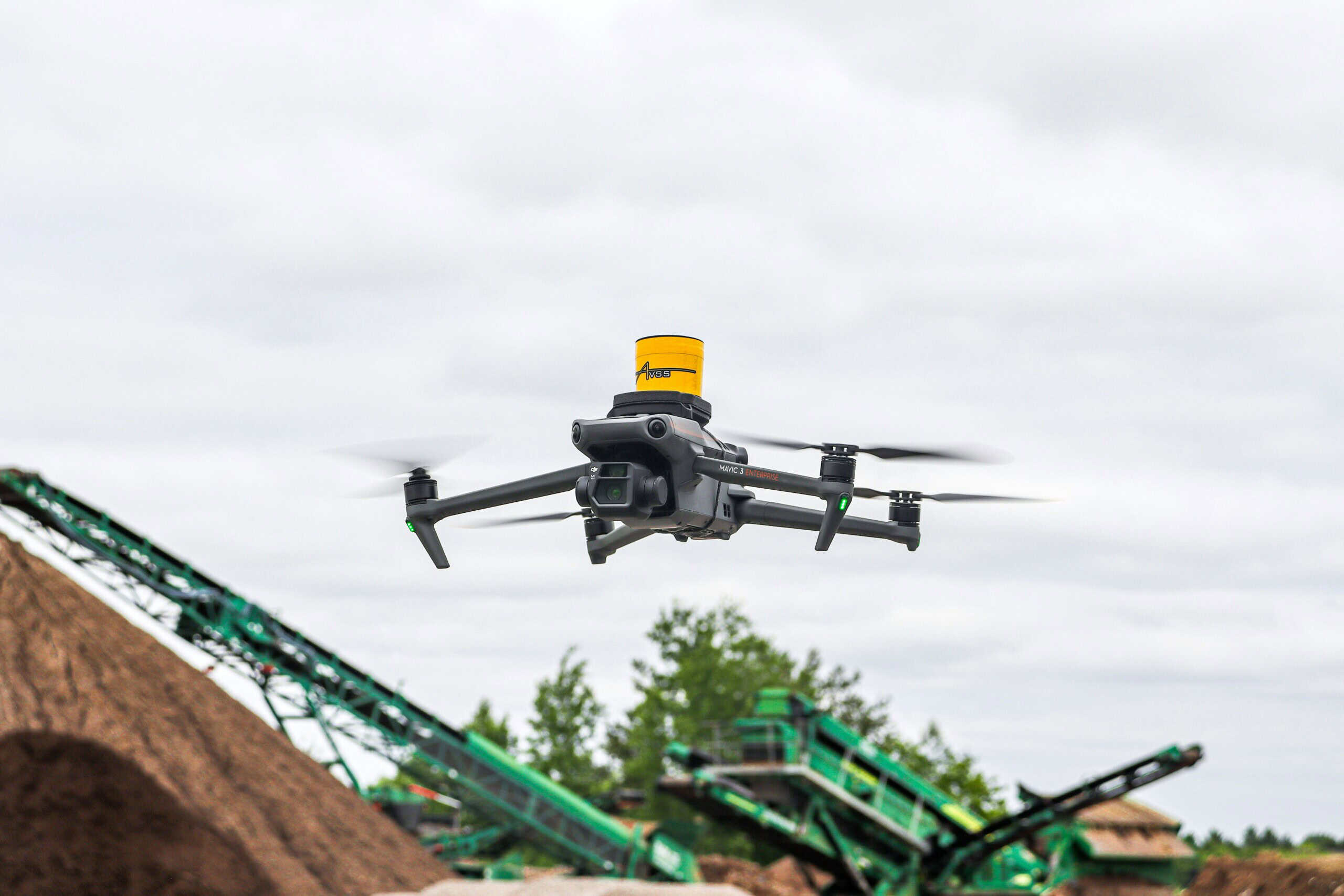
A drone survey can reduce a site inspection that once took three days on foot to a single morning of flying, and it does so without putting a single person on a scaffold, roof edge or unstable embankment. That is not a marketing claim. It is the practical reality that property developers, contractors and infrastructure managers across the UK are now working with, and it is changing how inspection programmes are planned, priced and delivered.
Yet plenty of confusion remains. Some clients still assume drone surveying means a hobbyist with a camera producing pretty aerial photographs. Others expect a UAV to replace every ground-based technique overnight. Neither is true. This article explains where drone surveys genuinely accelerate site inspections, where they do not, and what separates survey-grade aerial data from footage that looks impressive but cannot be measured, trusted or submitted.
The Industry Reality: Why Traditional Site Inspections Slow Projects Down
Conventional site inspections carry three costs that rarely appear on the quotation but always appear in the programme.
The first is access. Inspecting a roof, a bridge soffit, a quarry face or a live railway corridor typically requires scaffolding, mobile elevating work platforms, rope access teams or possession bookings. Each of these adds days or weeks of lead time before anyone has looked at anything.
The second is safety exposure. Falls from height remain one of the most persistent causes of serious injury in UK construction. Every hour a surveyor or engineer spends at height, near plant, or beside live traffic is an hour of risk that must be assessed, controlled and insured.
The third is coverage. A person walking a 40 hectare development site with a total station or GPS pole captures discrete points. They capture what they were asked to capture. Anything outside the brief, a drainage issue at the far boundary, an encroachment, early signs of slope movement, often goes unrecorded until it becomes a problem.
Drone surveys address all three simultaneously, which is why the technology has moved from novelty to standard practice on well-run UK projects.
What a Professional Drone Survey Actually Delivers
A common misconception is that a UAV survey produces video. In reality, a professional aerial surveying operation delivers measurable geospatial data, typically including:
Orthophotos. Geometrically corrected aerial imagery, accurate to scale, that can be dropped straight into CAD or GIS. Unlike a standard aerial photograph, every point on an orthophoto sits in its correct position, so distances and areas measured from it are reliable.
Point clouds. Millions of individually coordinated 3D points generated through photogrammetry or aerial LiDAR, capturing the site’s surfaces in dense detail. These integrate with data from terrestrial 3D laser scanning, allowing a complete site model that covers both what the drone sees from above and what ground-based scanners capture at close range.
Digital terrain and surface models. Essential for earthworks calculations, flood risk assessment, drainage design and cut and fill analysis.
Volumetric data. Stockpile volumes measured in minutes rather than half a day of walking with a GPS pole, with repeatable accuracy that makes month-on-month comparisons meaningful.
Inspection imagery. High-resolution, geotagged stills of roofs, facades, gantries and structures, captured close enough to identify cracked slates, corroded fixings or failed pointing without anyone leaving the ground.
The distinction matters. Data you can measure supports design decisions, planning submissions, dilapidation records and dispute resolution. Footage you can only watch does not.
Where Drone Surveys Genuinely Speed Up Inspections
Large or Complex Sites
On open land, the speed difference is dramatic. A topographical survey of a 50 hectare site that might occupy a two-person ground team for a week can be flown in a day, with processing completed shortly after. The drone does not tire, does not miss areas, and captures uniform density across the whole site rather than concentrating detail where the surveyor happened to walk.
Roofs and Building Envelopes
Roof inspections are perhaps the clearest safety and speed win. A traditional roof condition inspection needs edge protection, a MEWP or scaffold access, each with hire costs and lead times. A drone survey captures the entire roofscape in high resolution within an hour or two of arriving on site, including valleys, hidden gutters and areas no cherry picker could safely reach. For measured building survey work, the aerial data also fills in roof geometry that ground-based instruments simply cannot see.
Live and Hazardous Environments
Quarries, landfill sites, rail corridors, waterways and contaminated land all share the same problem: putting people on them is slow, expensive and risky. A UAV flying overhead removes the person from the hazard entirely. On watercourse and flood assessment work, aerial data captures bank conditions and channel context that would otherwise require access agreements, waders and considerable time.
Progress Monitoring and Repeat Inspections
Because a drone flight is fast and repeatable, monthly or even weekly site inspections become practical. Flying the same flight plan each visit produces directly comparable datasets, so earthworks progress, stockpile movement and construction sequencing can be tracked objectively. Contractors increasingly use this for valuation evidence, and clients use it to verify what they are being invoiced for.
The Safety Case: Removing People from Risk, Not Just Reducing It
Most safety improvements in surveying reduce risk. Drone surveys frequently eliminate it, and that distinction is worth dwelling on.
Under the hierarchy of controls that underpins UK health and safety practice, elimination sits at the top. Harnesses, guardrails and permits to work all manage a hazard that still exists. A drone survey removes the hazard from the equation: nobody works at height because nobody goes to height. Nobody enters the excavation, the roof void, the traffic lane or the unstable slope.
For principal contractors and clients with CDM duties, this has practical consequences. Method statements become simpler. Fewer permits are needed. Insurance exposure falls. And the inspection can often happen sooner, because the lead time for scaffolding or possession arrangements disappears.
There is a caveat, and an honest surveying company will state it plainly: the drone operation itself must be run safely and legally. In the UK, commercial survey flights are governed by the Civil Aviation Authority. Depending on the aircraft and environment, operators typically work under an Operational Authorisation with qualified remote pilots holding a GVC (General VFR Certificate), supported by site-specific risk assessments, airspace checks and, where required, permissions for congested areas or restricted zones. A professional operator handles all of this before arriving. If a provider cannot show you their CAA credentials and insurance, the safety benefit you were buying does not exist.
Speed Without Accuracy Is Worthless: What Separates Survey-Grade UAV Data
This is where experience shows, and where cheap drone work falls apart.
Any competent pilot can fly a grid and press a button. Producing data that an engineer can design from is a different discipline. Three factors determine whether drone mapping outputs are genuinely survey-grade:
Ground control. Accurate aerial data is tied to the ground through surveyed control points, established with GPS or total station observations by qualified land surveyors. Without proper ground control or verified RTK/PPK positioning, a model can look flawless while sitting half a metre from where it should be. Checkpoints, separate from the control used in processing, are how accuracy is proven rather than assumed.
Flight planning for purpose. Ground sample distance, image overlap, flying height and camera angle all need to be designed around the deliverable. A roof defect inspection, a topographical model and a volumetric stockpile survey require different flight plans. A one-size-fits-all flight produces one-size-fits-nobody data.
Processing and verification by surveyors. Photogrammetric processing involves judgement: filtering vegetation from terrain models, resolving areas of poor image texture, checking residuals against independent measurements. This is surveying knowledge applied to aerial data, not software left to run on defaults.
The practical test for any client is simple. Ask the provider what accuracy they will achieve, how they will prove it, and what format the deliverables will arrive in. A professional answer includes numbers, method and file formats compatible with your CAD, BIM or GIS environment. A vague answer tells you everything.
Where a Drone Survey Is Not the Right Tool
Credibility requires honesty about limitations, so here it is.
Drones cannot see through canopy, so densely wooded sites still need ground survey or aerial LiDAR rather than photogrammetry. They cannot see underground, which is why utility surveys using EML and GPR to PAS 128, and CCTV drainage surveys, remain ground-based disciplines. Internal building spaces belong to terrestrial laser scanning and measured survey techniques. Weather stops play: sustained high winds, heavy rain or poor visibility will ground a flight, so programmes need modest contingency. And in certain controlled airspace or congested urban locations, additional permissions add lead time that must be planned for.
The best results on complex projects usually come from combining methods. A development site might use a drone survey for the open topography, laser scanning for building elevations, GPS control throughout, and a utility survey below ground, all coordinated on one grid and delivered as one integrated dataset. That integration is where a full-service geospatial company earns its fee, because the client receives a single coherent model rather than four datasets that do not quite agree.
A Real-World Comparison: The Same Inspection, Two Ways
Consider a distribution warehouse with a 20,000 square metre roof approaching the end of a lease, where the landlord needs condition evidence for dilapidations.
The traditional route: scaffold towers or MEWP hire, edge protection, a two-day inspection window subject to weather, operatives working at height throughout, disruption to yard operations below, and a report based on the areas the inspector could physically and safely reach. Realistic timescale from instruction to report: three to four weeks.
The drone route: airspace and site risk assessment in advance, a half-day visit, complete high-resolution coverage of every roof plane including fragile areas nobody could walk, geotagged imagery locating each defect precisely, and an orthophoto of the entire roof on which defects are mapped and measured. Yard operations continue uninterrupted. Timescale from instruction to deliverables: often inside a week.
Same inspection objective. A fraction of the time, a fraction of the risk, and arguably better evidence, because every defect is photographed in context and coordinated, not described from memory in a notebook.
What This Means for Your Project Programme
The strategic value of faster, safer inspections is not simply saving a few days. It changes what is possible:
Site acquisition decisions can be informed by real topographic data before purchase, not after. Design teams receive accurate existing-conditions models at RIBA Stage 1 rather than Stage 3, reducing redesign. Monthly aerial records create an objective, timestamped history of the site that protects all parties if disputes arise. And inspection frequency can increase without increasing risk, which means problems are caught earlier, when they are cheap to fix.
For infrastructure managers with large asset portfolios, the arithmetic is even more compelling. Assets that were inspected every five years because access was expensive can be inspected annually. Deterioration is tracked rather than discovered.
Choosing a Drone Survey Provider in the UK
Aerial surveying sits at the intersection of two professions: aviation and land surveying. A provider needs credibility in both. In practical terms, that means CAA authorisation and appropriate insurance on the aviation side, and chartered surveying standards, established control procedures and recognised quality management on the measurement side.
Premier Surveys has been delivering surveying and geospatial services across the UK since 1989, is regulated by RICS and certified to ISO 9001:2015. Drone survey work sits alongside topographical surveys, 3D laser scanning, measured building surveys, engineering surveys and utility detection, which means aerial data is captured, controlled and verified by land surveyors and integrated with ground-based techniques where projects demand it. With offices in Nottingham and London, teams operate nationwide across construction, infrastructure, property and environmental sectors.
Final Thoughts
A drone survey is not a gadget bolted onto traditional surveying. Used properly, it is a genuine change in how quickly and safely site information can be gathered: inspections in hours instead of days, people removed from height and hazard entirely, and measurable data rather than anecdotal reports. Used badly, without ground control, aviation compliance or surveying rigour, it is expensive footage.
The difference lies entirely in who is flying, planning and processing the work. If your next site inspection involves height, hazard, scale or a deadline, it is worth asking whether it needs to involve people standing in harm’s way at all.
To discuss how a drone survey could accelerate your next inspection programme, contact Premier Surveys for practical advice on the right approach for your site.