
PAS 128 underground utility surveys get specified the same way far too often: a single line in a tender document asking for “a utility survey to PAS 128”, with no quality level, no extent definition, and no deliverable spec. That line decides whether your project hits an unmapped 11kV cable on week two.
The industry reality
Most utility records are incomplete or wrong. Statutory undertaker plans are frequently decades old, drawn from sketches, transferred between systems with errors, or simply never updated when services were rerouted. PAS 128 exists because the industry needed a shared language for what level of confidence a buried services drawing actually represents. It is not a tick box on a quote sheet.
The standard was published in 2014 and updated to give specifiers four distinct quality levels. Most clients still ask for “PAS 128” without picking one. The result is a quote race to the cheapest interpretation, which usually means a desktop study with a light site walk and a drawing that looks comprehensive but carries almost no detection confidence.
What actually matters
The four quality levels are not interchangeable
QL-D is a desktop study built from statutory records. It tells you what should be there, not what is.
QL-C adds site reconnaissance to verify visible features (covers, markers, surface evidence). Still no detection.
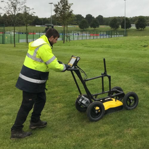
QL-B uses active detection: Electromagnetic Location (EML) and Ground Penetrating Radar (GPR). This is what most people imagine when they ask for “a utility survey”.
QL-A verifies depth and position by physical exposure, usually trial pits or vacuum excavation. This is the only level that gives true positional certainty.
A QL-B survey is not a QL-A survey with the lid off. Treating them as the same is how cables get hit.
EML and GPR detect different things
EML traces conductive services: live cables, metal pipes, traced ducts with an insertable rod. It will miss plastic water mains, ceramic drainage, abandoned cables without continuity, and most fibre. GPR fills the gap but performance depends on ground conditions. Wet clay, reinforced concrete, and high salt content all reduce penetration depth, sometimes to under half a metre.
A competent surveyor will state, in writing, what conditions limited detection on the day of survey. If your report has no such note, you do not have a complete picture.
The cost of an unmapped strike is asymmetric
A typical PAS 128 QL-B survey for a moderate urban site sits in the low thousands. A struck high-voltage cable starts at five figures before anyone calculates downtime, statutory undertaker reinstatement, injury claims, or project delay. HSE prosecutions following utility strikes regularly cite inadequate survey specification, not just operator error. If you commission the design, you carry that risk under CDM 2015.
How to write a brief that gets you the survey you actually need
State the quality level required at each part of the site. High-risk areas near known services may need QL-A; large open areas may justify QL-B.
Define the extent precisely with a marked-up plan, not just a postcode or red line. Include any planned excavation outside the building footprint.
Specify deliverable format. CAD with layered services on a known coordinate system is standard. Asking for “a drawing” gets you a PDF nobody can use.
Require confidence ratings against each traced service, and a written note on ground conditions.
Specify reissue terms. If the design extent changes, the survey scope changes too.
A real scenario
A forecourt redevelopment in central Nottingham was let to a contractor with a one-line brief for “PAS 128 utility survey”. The survey returned at QL-B with all visible services traced. During the design stage, the architect extended the dig line two metres north to accommodate a new drainage run. The survey extent was not reissued. Excavation struck a 4-inch cast iron gas main running just outside the original survey boundary, on records as “abandoned” but in fact still live and supplying a neighbouring building.
The strike caused a full site evacuation, statutory undertaker emergency works, and a six-day programme delay. The original survey was not at fault. The brief was. A re-survey of the extended dig line would have cost less than one day of standstill.
The insight most clients miss
A utility survey is a snapshot tied to a defined extent on a defined date. The strongest projects treat it as a live document. If your dig boundary moves, your survey scope moves. If a service appears unexpectedly during enabling works, the report gets updated and reissued, not annotated by hand and forgotten in someone’s email. The cost of doing this properly is rounding error against the cost of doing it wrong once.
Why Premier Surveys approaches it differently
At Premier Surveys, our underground utility surveys are scoped at the brief stage to the PAS 128 quality level that fits the actual risk on each part of the site, not a blanket “QL-B” across everything. We deliver combined EML and GPR sweeps, layered CAD output on your project coordinate system, confidence ratings on every traced service, and a written note on ground conditions that limited detection. If your design extent changes, we update the scope rather than letting the original drawing carry the responsibility for ground it never covered.
Conclusion
A utility survey is worth what is specified in the brief. The specification problem is rarely the surveyor; it is the line item that says “PAS 128” and stops there. Pick the quality level deliberately, define the extent against the design (not the red line), and treat the deliverable as something that updates when the project does. Get those three right and most utility strikes become avoidable rather than unlucky.