
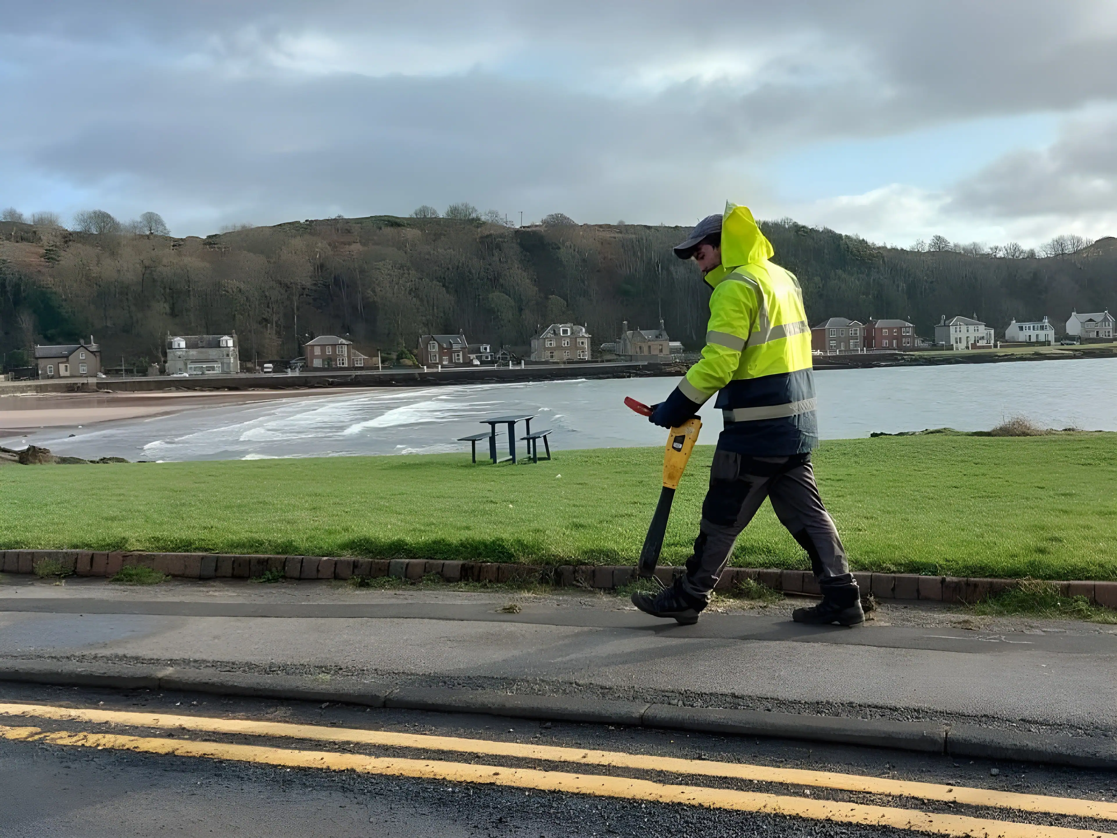
A PAS 128 utility survey is no longer a nice-to-have on UK construction and infrastructure projects. It is rapidly becoming the default requirement written into tenders, pre-construction information packs and client specifications, and for good reason. Anyone who has watched a project stall because an excavator found a high-voltage cable that “was not supposed to be there” understands why the industry has moved towards a formal, auditable standard for underground utility mapping.
Plenty of articles will tell you that PAS 128 is “a specification for utility surveys” and leave it at that. That definition is technically accurate and practically useless. If you are a developer, civil engineer or project manager deciding whether to commission a PAS 128 survey, what you actually need to know is what the specification changes, what it does not guarantee, and how to use its quality levels to manage risk on your specific site. That is what this article covers.
The Industry Reality: Why Underground Risk Forced a Standard
Before PAS 128 was first published by the British Standards Institution in 2014, utility surveying in the UK was inconsistent. Two firms could quote for the same job, both call it a “utility survey”, and deliver completely different levels of rigour. One might trace a few services with a cable locator and mark them on a plan. Another might combine statutory records, electromagnetic detection and ground penetrating radar into a fully attributed CAD deliverable. The client, who often had no way to tell the difference until something went wrong, was buying blind.
The consequences of that inconsistency are well documented. Tens of thousands of utility strikes are recorded across the UK every year, and research into strike incidents has repeatedly shown that the true cost of a strike far exceeds the immediate repair bill. Programme delays, redesign, emergency service attendance, compensation claims, HSE involvement and reputational damage all stack on top of the direct cost. Industry studies have estimated that indirect costs can multiply the direct repair cost many times over.
Add to that the legal context. Under CDM 2015, clients and designers have a duty to identify and manage foreseeable risks, and the HSE’s guidance document HSG47, Avoiding Danger from Underground Services, makes clear that relying on utility record drawings alone is not an adequate approach to locating buried services. Statutory records are frequently incomplete, out of date or positionally inaccurate, particularly on older urban sites where services have been added, abandoned and diverted over decades.
PAS 128 emerged as the industry’s answer: a specification that defines how underground utility detection, verification and location should be carried out, and crucially, how the confidence in each result should be communicated. The specification was updated in 2022 to reflect improvements in technology and practice, which reinforced its position as the reference standard for underground services detection in the UK.
What a PAS 128 Utility Survey Actually Involves
At its core, PAS 128 does two things that older, unspecified utility surveys did not.
First, it standardises methodology. A survey delivered to PAS 128 follows defined procedures for desktop research, site reconnaissance, geophysical detection and physical verification. The specification covers how techniques such as electromagnetic location (EML) and ground penetrating radar (GPR) should be deployed, including survey grid spacing and the requirement to use multiple detection methods rather than relying on a single technique.
Second, and arguably more importantly, it standardises honesty. Every detected utility in a PAS 128 deliverable carries a quality level that tells you exactly how that position was established and how much confidence you can place in it. This is the part of the specification that genuinely changed the industry, because it forces the survey provider to declare the limits of their data rather than presenting every line on the drawing as equally reliable.
The Four Quality Levels Explained
PAS 128 defines a hierarchy of quality levels, and understanding them is the single most useful thing a client can do before commissioning a survey.
QL-D: Desktop utility records search. Existing statutory undertakers’ records are gathered and collated onto a single plan. This is the baseline. It tells you what asset owners believe is in the ground, which is valuable for early feasibility work but should never be treated as an accurate positional record. Records can be schematic, decades old, or simply wrong.
QL-C: Site reconnaissance. The desktop records are reconciled against visible evidence on site, such as manhole covers, valve boxes, cabinets and street furniture. Discrepancies between the records and physical reality are identified. This level adds context but still involves no geophysical detection.
QL-B: Geophysical detection. This is where an EML survey and GPR survey come into play. Trained surveyors use electromagnetic locators to trace conductive and signal-carrying services, and ground penetrating radar to detect non-conductive utilities such as plastic water pipes, clay drainage and fibre ducting that EML cannot find. QL-B is subdivided based on how reliably each service could be positioned in plan and depth, so a single drawing may contain segments at different sub-levels reflecting genuine variations in detection confidence across the site.
QL-A: Verification by exposure. The highest quality level. The utility is physically exposed, typically by vacuum excavation or hand-dug trial holes, and its precise position, depth, size and type are recorded. QL-A data is the only category that confirms a service beyond geophysical inference, which is why it is specified at critical locations such as piling positions, connection points and deep excavations.
The practical insight here is that quality levels are not a ranking of good to bad surveys. They are a risk management tool. A well-scoped project uses different quality levels in different areas depending on what the design and construction activity actually demands.
Why PAS 128 Is Becoming the Default Requirement
The shift towards PAS 128 as standard practice is being driven from several directions at once, and it is worth understanding each one because they explain why the trend will not reverse.
Clients and Principal Designers Are Specifying It
Major infrastructure programmes, local authorities, utility companies and national contractors now routinely write PAS 128 into their survey specifications. Once the largest buyers of survey services demand a standard, it cascades down the supply chain, and smaller developers who encounter it on framework projects begin specifying it on their own schemes.
It Makes Tenders Genuinely Comparable
Before PAS 128, comparing utility survey quotes was guesswork. A cheaper quote might reflect efficiency, or it might reflect a firm planning to walk the site with a single locator for an afternoon. When both quotes are for a PAS 128 survey to defined quality levels, the client is comparing like with like, which is exactly what procurement teams want.
It Supports the Duty of Care Under CDM 2015
Commissioning a PAS 128 utility survey is demonstrable evidence that a client or designer took reasonable steps to identify buried services before excavation. If an incident does occur, the difference between “we looked at the utility records” and “we commissioned a survey to a recognised British specification, with declared quality levels, and designed accordingly” is significant, both practically and legally.
It Integrates With Digital Workflows
Modern projects run on coordinated digital information. PAS 128 deliverables, produced as attributed CAD drawings or GIS-ready data, feed directly into BIM environments and design models. Underground utility mapping that arrives as structured, quality-coded data is far more useful to a design team than a marked-up PDF, and the specification’s consistent attribution makes that integration straightforward.
Real-World Scenarios: Where the Specification Earns Its Keep
Consider a brownfield residential development on a former industrial site in a city centre. The statutory records show a handful of services. A QL-B detection survey combining EML and GPR reveals a redundant but live-looking ductbank crossing the proposed basement, along with two water mains that sit several metres from their recorded positions. Because each detected service carries a quality level, the design team knows exactly which positions they can rely on and where QL-A trial holes are needed before the piling layout is finalised. The cost of those trial holes is trivial against the cost of redesigning a basement mid-construction.
Or take a highways scheme involving carriageway reconstruction. The contractor needs to know not just where services run, but their depth relative to the proposed formation level. GPR data with declared depth confidence lets the engineer identify pinch points where cover is marginal, and target verification only where it matters. Without quality-coded data, the alternative is either blanket trial holing, which is expensive, or optimistic assumption, which is dangerous.
These scenarios share a theme: PAS 128 does not simply find utilities. It tells decision-makers how much to trust each piece of information, which is what actually enables intelligent design and safe excavation.
What PAS 128 Does Not Do (And Why Honest Providers Say So)
Here is the part of the conversation that generic content avoids. PAS 128 is not a guarantee that every buried service will be found. No geophysical method is infallible. Deep services, congested corridors, reinforced concrete, wet clay soils that attenuate radar signals, and non-conductive pipes with no tracer wire all present genuine detection challenges. The specification acknowledges this, which is precisely why the quality level system exists.
What PAS 128 does guarantee is process and transparency. You will know which techniques were used, at what density, and how confident the surveyor is in every plotted position. Undetectable services are declared rather than quietly omitted. That transparency is what transforms a utility survey from a drawing into a risk management document.
A related point: the competence of the survey team matters as much as the specification itself. PAS 128 sets out the method, but interpreting GPR radargrams, distinguishing a genuine utility response from ground disturbance, and tracing complex signal paths with EML are skills built through experience. When comparing providers, ask about the qualifications and track record of the surveyors who will actually attend site, not just whether the quote references PAS 128.
Choosing the Right Survey Scope for Your Project
A sensible approach for most projects follows this pattern. Commission QL-D records early, at feasibility stage, so known constraints inform the concept design. Move to a QL-B detection survey across the working area once the site boundary and scheme layout are reasonably fixed, ideally before detailed design begins rather than after. Then specify QL-A verification at specific high-consequence locations: pile positions, service connection points, deep drainage runs and anywhere the detected data conflicts with the design.
Scoping in this sequence avoids the two most common and costly mistakes we see: surveying too late, when the design is already committed around assumptions, and specifying QL-A everywhere, which inflates cost without proportionate benefit.
Working With Premier Surveys
Premier Surveys has been delivering professional surveying services across the UK since 1989, with offices in Nottingham and London and a nationwide field capability. Our utility survey team carries out underground services detection and mapping using EML and GPR methods in line with PAS 128, and our work is backed by ISO 9001:2015 certified quality management and RICS regulation.
Because we also deliver topographical surveys, measured building surveys, 3D laser scanning and CCTV drainage surveys, utility data can be captured and coordinated alongside the wider survey information your project needs, on a common grid and datum, in the CAD, GIS or BIM format your design team works in. That coordination matters more than it sounds: a utility survey that does not align with the topographical base plan creates exactly the kind of positional ambiguity the survey was meant to remove.
Frequently Asked Questions
How much does a PAS 128 utility survey cost? Cost depends on site area, ground conditions, access, the quality levels specified and the density of buried services. A focused QL-B survey of a small development plot is a very different exercise from a multi-hectare site with QL-A verification. A clear scope based on your design risk will always produce a more accurate and competitive quote than a vague enquiry.
Is a PAS 128 survey a legal requirement? The specification itself is not law. However, CDM 2015 and HSG47 place clear duties on clients, designers and contractors to identify and manage the risks from underground services, and a PAS 128 survey is the recognised way of discharging that duty with auditable evidence.
Can GPR find everything underground? No, and any provider who claims otherwise should be treated with caution. GPR performance varies with soil conditions, depth and target material. That is why PAS 128 requires multiple techniques and, more importantly, requires the results to be quality-coded so limitations are visible rather than hidden.
The Bottom Line
PAS 128 is becoming the industry standard because it solved the underground surveying market’s biggest problem: nobody knew what they were buying. By standardising methodology and forcing transparent quality grading, the specification turned utility surveying from a variable commodity into a comparable, auditable risk management service. For anyone planning excavation, piling or infrastructure works in the UK, commissioning a PAS 128 utility survey early in the project is one of the cheapest forms of insurance available.
If you are scoping a project and want advice on the right quality levels for your site, speak to the team at Premier Surveys. We will tell you what the ground conditions and design risk actually justify, not simply what is easiest to quote.
Contact Premier Surveys for a PAS 128 utility survey quotation at https://premiersurveys.co.uk/